
News Highlight
Indian Space Research Organisation (ISRO) releases images of Earth captured by its EOS-06 satellite.
Key Takeaway
- The Indian Space Research Organisation (ISRO) has made available photos of Earth taken by the EOS-06 satellite.
- According to the space agency, the photos are a mosaic created by the ISRO’s National Remote Sensing Centre (NRSC).
- “Using photos collected by the Ocean Colour Monitor (OCM) payload on board EOS-06, NRSC/ISRO created a worldwide False Colour Composite (FCC) mosaic.”
- It went on to say that the mosaic with a spatial resolution of 1 km was created by integrating 2939 separate photos after processing 300 GB of data to portray the Earth between February 1 and February 15.
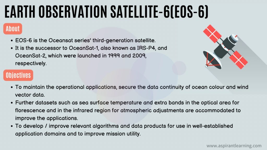
Earth Observation Satellite-6 (EOS-06) satellite
- About
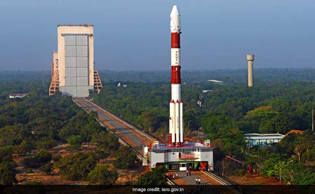
- The ISRO launched the third-generation Indian satellite for ocean monitoring, Earth Observation Satellite-6 (EOS-6).
- EOS-6 is an ocean observation satellite that will aid in monitoring many ocean elements.
- ISRO launched EOS-6 from its First Launch Pad (FLP) at Satish Dhawan Space Centre (SDSC), Sriharikota, in collaboration with the Ministry of Earth Sciences (MoES), among others.
- Oceansat-3 was launched into a polar orbit at approximately 740 kilometres above sea level.
- While at ~1100 kilograms, it is only slightly heavier than Oceansat-1 EOS-6 is carrying three ocean observing sensors viz;
- Ocean Color Monitor (OCM-3).
- Sea Surface Temperature Monitor (SSTM).
- Ku-Band scatterometer (SCAT-3).
- An ARGOS payload is also included.
- All of these sensors are important for India’s blue economy ambitions.
Significance of Earth Observation Satellite-6
- Every day, Earth Observation Satellite-6 will provide services to lakhs of users nationwide.
- These ocean observations will provide a solid basis for India’s blue economy and polar region policies.
- This is India’s first significant ocean satellite launch since the start of the UN Decade of Ocean Research for Sustainable Development (UNDOSSD, 2021-2030).
- The EOS-06 satellite will be able to measure Ocean Color, SST, and Sea Surface Winds all at the same time.
- It is projected to significantly boost the global scientific and operational communities‘ ocean observing capacities in tackling the Ocean Decade objectives and challenges.
EOS Series Launches
- EOS-01
- Earth Observation satellite is designed to aid agriculture, forestry, and disaster management.
- EOS-02
- The SSLV-1 payload is a demonstration satellite for several innovative technologies with applications such as agriculture, forestry, geology, and hydrology.
- EOS-03
- First Agile Earth Observation satellite in Geostationary orbit and applications.
- It includes near real-time imaging, quick monitoring of natural disasters, spectral signatures for agriculture, forestry etc.
- EOS-04
- Radar Imaging satellites are designed to deliver high-quality images in all weather circumstances for agricultural, forestry, and plantation applications.
- As well as soil moisture and hydrology, and flood mapping.
- EOS-05
- Earth Observation Satellite in the Geostationary Orbit.
- EOS-06
- Earth Observation satellite designed for ocean-related services and advisories such as possible fishing zone and ocean state forecasting.
Sea Surface Temperature Monitor (SSTM)
- The SSTM will give ocean surface temperature, a vital ocean parameter for forecasting everything from fish aggregation to cyclone formation and movement.
- Temperature is an important indicator for monitoring coral reef health and, if necessary, providing coral bleaching alerts.
Ocean Color Monitor (OCM-3)
- Every day, the advanced 13-channel OCM with 360 m spatial resolution will observe the day side of the Earth.
- It will provide critical information on the spread of ocean algae, which is the foundation of the food chain in the marine ecosystem.
- The OCM-3’s excellent signal-to-noise ratio is intended to increase accuracy in daily phytoplankton monitoring.
- Its operational and scientific uses include fishing resource management, ocean carbon uptake, dangerous algal bloom alerts, and climate studies.
Pic Courtesy: NDTV
Content Source: The Hindu