News highlights:
- India-U.S. space cooperation: India and the US are expanding their space cooperation in several areas, including human space exploration and commercial space partnership.
- Collaboration on extremely specialised projects like the NASA-ISRO Synthetic Aperture Radar (NISAR) programme could potentially represent the sustained commitment of both countries.
India-U.S. space cooperation:
- Overview:
- The biggest cooperation between the United States and India in civil space is the NASA-ISRO Synthetic Aperture Radar (NISAR) Earth science mission, which features a jointly-developed SAR payload that will be integrated into an Indian-built satellite and launched by India in 2024.
- India US are major spacefaring nations with significant investment in space; their societies and militaries are dependent on space for several critical functions.
- Therefore, any disruptions of their space assets would result in social and economic disruption and interference with the effectiveness of their militaries.
- Beyond space launches, India and the US have started cooperating in Satellite Navigation (SatNav).
- The U.S. and India also have a deep, cooperative relationship in weather systems and applications, which rely heavily on space technologies.

NASA-ISRO Synthetic Aperture Radar (NISAR) programme:
- About:
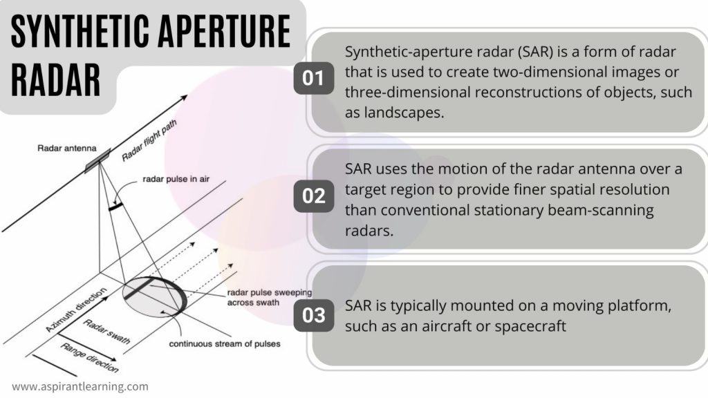
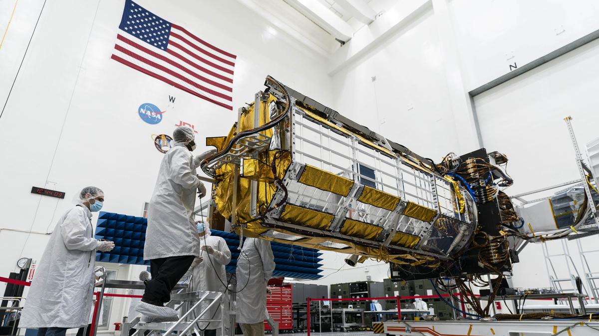
- The NASA-ISRO Synthetic Aperture Radar (NISAR) mission is a joint project between NASA and ISRO to co-develop and launch a dual-frequency synthetic aperture radar on an Earth observation satellite.
- The satellite will be the first radar imaging satellite to use dual frequencies.
- A dual-frequency Radar imaging satellite use both L-Brand and S-Brand Radar frequencies.
- ISRO is building the S-Brand Radar, and NASA is building the L-Brand Radar
- It will be used for remote sensing to observe and understand natural processes on Earth.
- Overview:
- With a resolution of 5 to 10 metres, the NASA-ISRO Synthetic Aperture Radar, or NISAR, the satellite will survey the height of Earth’s land and ice masses four to six times per month.
- It is designed to observe and measure some of the planet’s most complex natural processes, including ecosystem disturbances, ice-sheet collapse, and natural hazards such as earthquakes, tsunamis, volcanoes and landslides.
- Data collected from NISAR will reveal information about the evolution and state of Earth’s crust, help scientists better understand our planet’s natural processes and changing climate, and aid future resource and hazard management.
- Mission partnership:
- The mission is a partnership between NASA and ISRO.
- Under the terms of the agreement, NASA will provide the mission’s L-band synthetic aperture radar (SAR), a high-rate telecommunication subsystem for scientific data GPS receivers, a solid-state recorder, and a payload data subsystem.
- ISRO will provide the satellite bus, an S-band synthetic aperture radar, the launch vehicle, and associated launch services.
Benefits of NISAR:
- Collects data on earth’s surface:
- To increase our understanding of Earth system processes and climate change, NISAR will provide a variety of data and information regarding the Earth’s surface changes, natural hazards, and ecosystem disturbances.
- The mission will provide critical information to help manage natural disasters such as earthquakes, tsunamis, and volcanic eruptions, enabling faster response times and better risk assessments.
- Improve agricultural management:
- By providing data on crop growth, soil moisture, and land-use changes, NISAR data will be utilised to enhance agriculture management and food security.
- Climate Change:
- NISAR will aid in understanding how climate change affects the planet’s terrestrial surface, including changes to carbon storage, sea level rise, and melting glaciers.
- Coastal data:
- NISAR will acquire data over the Indian Coasts and monitor annual changes in the bathymetry along the deltaic regions.
- The shoreline and erosion accretion also will be monitored.
- Protecting water and Oil Spills:
- The required information on oil and chemical spills that threaten people and the environment can be obtained via radar remote sensing.
- Marine Hazards:
- NISAR will provide information to monitor ocean wind, waves, and sea-ice extent that can aid weather forecasting and warn of marine hazards.
- Its coverage of coastal oceans benefits sea transportation and coastal communities.
Pic Courtesy: The Hindu
Content Source: The Hindu


