
Sino-Indian Border Dispute: 20 Indian personnel sustain minor injuries in LAC face-off on Dec. 9
Key Takeaway
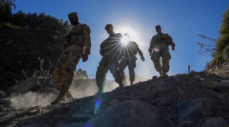
- Indian and Chinese soldiers suffered “minor injuries” after they were engaged in a face-off along the Line of Actual Control (LAC) in the Tawang sector of Arunachal Pradesh on December 9.
- Since the battles at Eastern Ladakh, there haven’t been any reports of such engagements between Indian and Chinese forces.
- After the clash, the Indian side is said to have used Radio Frequency (RF) signal geolocation equipment to reconstruct satellite images.
- The Indian military and security establishment are presently analysing the high-resolution satellite imagery.
Sino-Indian Border Dispute
- A Brief Introduction
- Over seven decades, the Sino-Indian border dispute has become an intractable disagreement with no resolution.
- When the PRC invaded Tibet in the early 1950s, it raised the issue of a disputed border.
- As a result, China and India now share one of the world’s longest undemarcated frontiers.
- The proximity of the Chinese military presence so close to the undemarcated frontier created considerable consternation in New Delhi.
- Two flanks of territory located at the two ends of the extended boundary were at the centre of the conflict.
- And the western Aksai Chin region and the North Eastern Frontier Agency (NEFA), currently in Arunachal Pradesh, are controlled and governed by India.
- Managing the Border Dispute
- Sino-Indian talks on the border dispute began in the 1980s after Atal Bihari Vajpayee, the Indian foreign minister, visited China in 1979 and contributed to lowering tensions in the two country’s relations.
- However, confidence-boosting initiatives started in the 1990s, after the two nations’ border police had started to conflict.
- During P.V. Narasimha Rao’s trip to Beijing in 1993, a significant breakthrough was made.
- The two leaders penned the Agreement on the Maintenance of Peace and Tranquillity.
- Hence, they demanded that the use of force cease, that the LAC be acknowledged and respected and that the boundary dispute is settled through talks.
- Another high point of border dispute management was reached with the 1996 signing of the Agreement on Confidence Building Measures in the Military Field along the LAC in the India-China Border Areas.
- The Political Parameters and Guiding Principles for the Settlement of India-China Boundary Questions, signed in 2005.
- And, It established a more tangible framework for resolving the territorial conflict.
Assessing the success of Border Dispute Management Talks and Confidence-Building Measures
- The effectiveness of the bilateral dialogue mechanisms and confidence-building measures described above must be evaluated in three ways:
- Management of border conflict
- Addressing the bilateral trust deficit
- Resolution of the border dispute.
- The two countries’ military standoffs have become more challenging to resolve.
- Despite high-level political and diplomatic exchanges and frequent top-level meetings, the trust gap between the two countries has only grown.
- In recent years, the two countries have engaged in a vigorous border infrastructure race.
- Both sides have invested in extensive road and railway connections on their respective sides of the border, upgrading military facilities and increasing overall troop deployments for rapid mobilisation.
- The border dispute remains unresolved despite fifteen Joint Working Group meetings and eighteen rounds of Special Representative Dialogues.
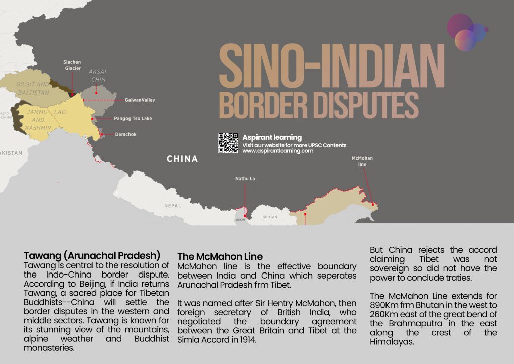
Line of Actual Control
- The LAC is the demarcation that separates Indian-controlled territory from Chinese-controlled territory.
- India considers the LAC to be 3,488 km long, while the Chinese consider it only around 2,000 km.
- It is divided into three sectors:
- The Eastern sector-which spans Arunachal Pradesh and Sikkim.
- Middle sector in Uttarakhand and Himachal Pradesh.
- Furthermore, the Western sector-in Ladakh.
Three Disputed sectors of the Sino-Indian border
- Western Sector:
- Firstly, the main concern of the dispute in the Western Sector is related to the sovereignty of the Aksai Chin region.
- India argues that Aksai Chin is part of the Indian territory of Ladakh, but on the other side, China argues that Aksai Chin is part of the Xinjiang province of China.
- The historical root cause of the dispute can be traced back to the period of British rule.
- And, The Line of Actual Control (LAC) borders Indian Ladakh and Aksai Chin. It runs parallel to the Chinese claim line of Aksai Chin.
- Middle Sector:
- In the middle sector, India and China share around 625 kilometres of the border, which run along Indian states like Uttarakhand and Himachal and terminate at Nepal, where a trijunction of Lipulekh is located.
- Hence, This is the only area where the two countries have reached a consensus.
- Eastern Sector:
- In the Eastern Sector, India shares a border of 1140 km, and borders run along the Indian states like Arunachal Pradesh.
- In addition, the border is demarcated as the McMahon line that extends from the eastern limit of Bhutan to a point near the Talu Pass at the trijunction of Tibet, India, and Myanmar.
- Thus, China claims most of Arunachal Pradesh’s territory is part of Southern Tibet.
Pic Courtesy: Indian Express
Content Source: Indian Express