News Highlight
The ongoing La Niña phase of the equatorial Pacific Ocean has just been predicted to persist for at least another six months, making it one of the longest ever La Niña episodes in recorded history.
Key Takeaways
- The World Meteorological Organisation (WMO) on August 31 had stated for the first time this century, it would span three consecutive northern hemisphere winters to become a ‘triple dip’.
- This is likely to have wide-ranging implications for weather events across the world in the coming months, and can potentially aggravate both floods and droughts in different regions.
El Niño Southern Oscillations, or ENSO
- The periodic warming and cooling of surface waters in the equatorial Pacific Ocean — a phenomenon described as El Niño Southern Oscillations, or ENSO
- ENSO is known to trigger widespread changes in atmospheric conditions, and has a major influence on global weather patterns, including the Indian monsoon.
- La Niña refers to the ENSO phase in which sea-surface temperatures are cooler than normal. The warmer phase is known as El Niño.
- A result of interactions between ocean and wind systems, El Niño and La Niña have almost opposite impacts on weather events.
El Nino
- Under ‘normal’ conditions, though, the west tropical Pacific is warmer than its eastern basin. The warmer area of the ocean is also a source for convection and is associated with cloudiness and rainfall.
- During El Niño, surface water in the central and eastern equatorial Pacific Ocean is unusually warm.
- Trade winds blowing from east to west weaken, and the warm surface waters that typically stay in the western Pacific are further pushed back to east along the equator.
- Therefore the warmth shifts to the Central and East Tropical Pacific and along with it, cloudiness and rainfall.
- It occurs more frequently than La Nina.
La Nina
- La Niña is characterised by the opposite process:
- During La Nina, sea surface temperatures in the eastern and central Pacific Oceans are colder than normal.
- The trade winds strengthen, and warm water and rainstorms are pushed to the far western equatorial Pacific over Indonesia
- an abnormal accumulation of cold water can occur in the central and eastern Pacific.
‘Triple dip’ La Niña
- Normal Condition:
- El Niño and La Niña episodes typically last for about nine months to a year. They usually develop in the March-June period, and are the strongest during winter (November-January in the northern hemisphere).
- Stretched phases:
- Occasionally, these El Niño and La Nina episodes continue for much longer periods.
- In recent years, the El Niño of 2015-16, spread over 19 months, was one of the longest on record, and was dubbed ‘Godzilla’ due to its sustained high intensity.
- Occasionally, these El Niño and La Nina episodes continue for much longer periods.
- Current context:
- The current episode has already surpassed that in length.
- Having started in September 2020, it has prevailed for the last 24 months, and looks set to continue for another six months, and has thus been classified as a ‘triple.
Evaluating the likely impact on India
- La Niña is associated with good rainfall during the monsoon season. This is the opposite of El Niño which is known to suppress monsoon r ainfall.
- Thus, a continued spell of La Nina could lead to expectation of another year of good, or normal, rainfall during the monsoon.
- This year, India has received 740.3 mm of rainfall, which was quantitatively 7 per cent above the seasonal average till August 30.
- But, even though powerful, the ENSO condition is not the only factor affecting monsoon rainfall in India and no one-on-one correlation exists between the ENSO condition and the amount of rainfall.
- Also, the influence of ENSO is at a macro level. There are wide variations in rainfall at the local level, which are getting exacerbated by climate change.
Impact on other regions
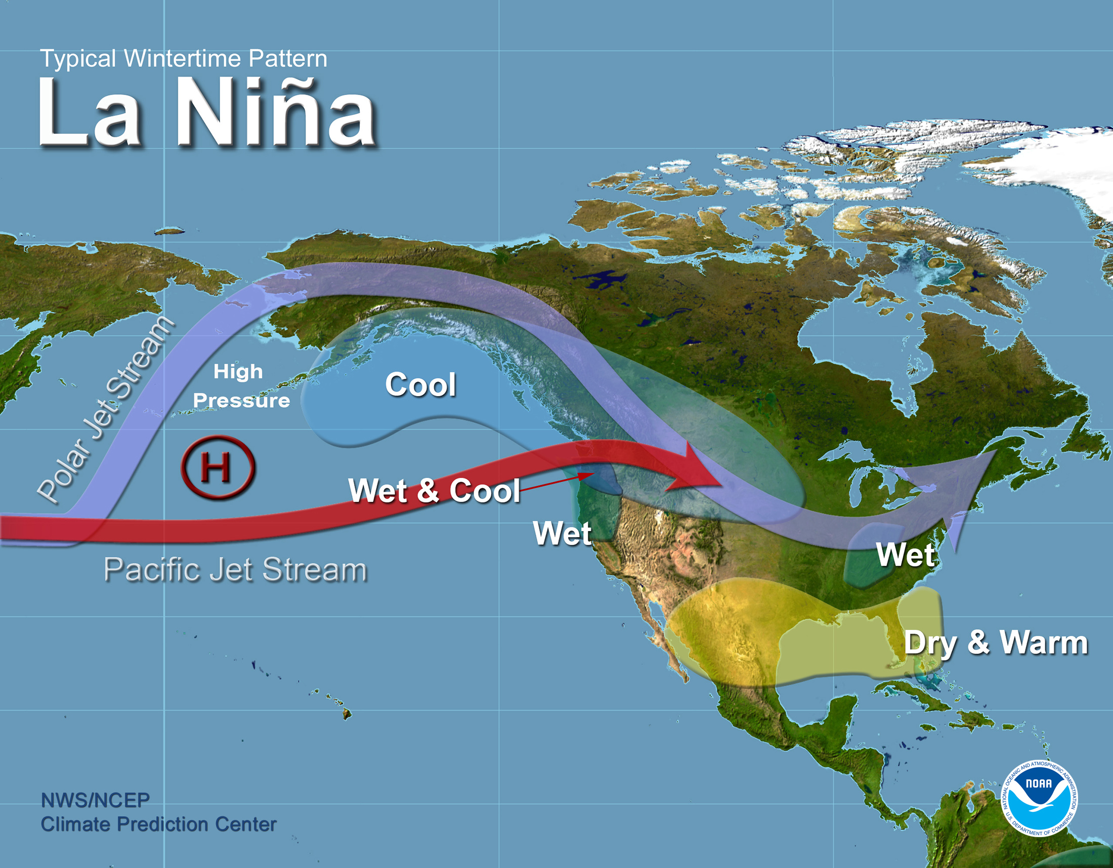
- In most parts of the United States, for example, La Nina is associated with very dry winters. The recent widespread drought in the United States is also its consequence.
- Recently, the National Oceanic and Atmospheric Administration (NOAA) of the United States declared that the month of August in 2022 was the sixth hottest August in the last 143 years.
- In Australia and Indonesia, and generally in the tropical region, it is expected to bring more rainfall. For example, flooding in eastern Australia this year.
- The excessive rainfall in Pakistan, which is experiencing its worst flooding disaster, can also be blamed in part on La Niña.
- As per World Meteorological Organisation (WMO), the the persistence of La Niña could most likely result in a worsening of the drought in Africa.
- The experts are also suggesting that as a result of this triple dip, there world will witness an overactive Atlantic Hurricane season in 2022.
Content Source: Indian Express


